Kalawao County Property Tax Records
Kalawao County is unlike any other county in the United States when it comes to property tax records. It sits on the Kalaupapa Peninsula on the north shore of Molokai and has a population of roughly 82 people. No county government exists here, and no property tax is levied on residents. The Hawaii State Department of Health administers the area under state law. Any taxable properties within Kalawao's boundaries are handled by neighboring Maui County for assessment purposes. If you are looking for property records connected to this peninsula, this page explains exactly where to turn and what records exist.
Kalawao County Overview
What Makes Kalawao County Unique
Kalawao County holds the distinction of being the smallest county in the United States by both land area and population. It covers about 13 square miles on the Kalaupapa Peninsula, a flat promontory jutting out from the base of towering sea cliffs on Molokai's north shore. Those cliffs, called pali in Hawaiian, rise more than 1,600 feet straight up. There are no roads that connect the peninsula to the rest of Molokai. You can only get there by trail, mule ride, or small aircraft. Visitors need a permit from the Hawaii State Department of Health before they can enter.
The county became what it is because of history. In 1866, the Hawaiian government began isolating people with Hansen's Disease (then called leprosy) on the peninsula. The settlement that grew up there housed thousands of patients over the following century. The last forced isolation ended in 1969. A small number of former patients, now elderly, still choose to live out their days on the land they have known for most of their lives. National Park Service staff and State Department of Health workers make up the rest of the current population.
There is no county council, no county mayor, no county tax office, and no county budget. The Hawaii State Department of Health runs operations at the settlement under Hawaii Revised Statutes Chapter 326. The state owns most of the land and buildings. That arrangement has lasted for well over a century and is still in place today.
The settlement is now part of Kalaupapa National Historical Park, which the National Park Service manages in close partnership with the State Department of Health. The NPS oversees preservation of the buildings, landscape, and records connected to the park. Federal land ownership adds another layer to why no conventional county property tax structure applies here.
Property Tax in Kalawao County
No property tax is levied in Kalawao County. That is not a loophole or an oversight. It follows directly from the fact that there is no county government to collect one. Under Hawaii law, real property taxes are a county function. Each of Hawaii's four counties, Honolulu, Hawaii, Maui, and Kauai, runs its own Real Property Assessment Division and sets its own tax rates. Kalawao has none of those things.
The state owns the vast majority of land within the settlement boundaries. Patient homes, churches, administrative buildings, and the airstrip are all state-owned structures managed by the Department of Health. Federal land under NPS management is exempt from property taxation by its nature. The combination of state ownership, federal park status, and the absence of any county taxing authority means residents do not get property tax bills. They never have.
There are a small number of privately held or institutionally owned properties within Kalawao's boundaries. Churches, for example, have had a presence on the peninsula for more than 150 years. For those limited cases, Maui County handles the administrative side. The Maui County Real Property Assessment Division serves as the practical point of contact for any taxable parcels that may exist within Kalawao, since Kalawao has no infrastructure of its own to carry out assessments or collections. Kalawao's statistical tax data, to whatever small extent it exists, rolls into Maui County's broader reporting.
If you believe you have a property interest in Kalawao County that may require tax attention, contacting Maui County Real Property Assessment Division is the right step. Their office is at 200 S. High Street, Wailuku, HI 96793. You can reach them by phone at (808) 270-7691. Their online portal is at mauipropertytax.com. Any applicable tax rates would be Maui County rates, not a separate Kalawao schedule.
Note: If you received a property tax notice referencing Kalawao County property, it was issued by Maui County on Kalawao's behalf. Contact Maui County Real Property Assessment at (808) 270-7691 with any questions.
Kalaupapa National Historical Park
The National Park Service designated Kalaupapa National Historical Park in 1980. The park covers most of the Kalaupapa Peninsula and exists to preserve and interpret the history of the Hansen's Disease settlement. Because NPS manages so much of the land and built environment here, federal property records and management plans play a significant role in understanding what exists on the peninsula.
The NPS holds detailed records on the structures within the park boundary. There are more than 50 historic buildings, including patient homes, hospitals, churches, and administrative offices. The park service tracks the condition and ownership status of each structure. These records are not conventional property tax assessment records, but they document real property in the way that makes sense for a national park.
The image below is from the Kalaupapa National Historical Park website, which is the primary public-facing resource for learning about the settlement and the park's management of the area.
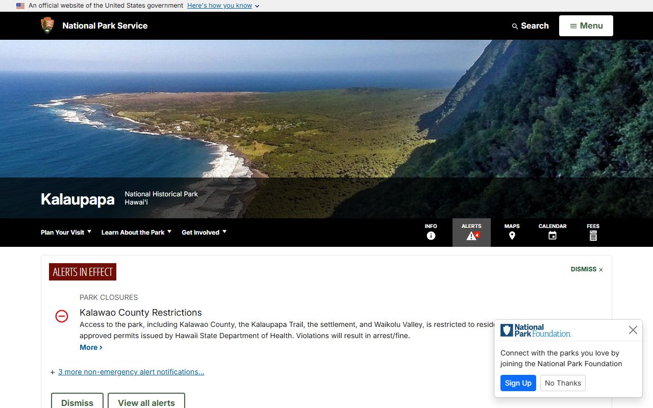
The NPS site is the starting point for understanding what the park covers, which lands are federally managed, and how the park relates to the State Department of Health's ongoing role in the settlement.
Access to the park is restricted out of respect for the former patients still living there. The Hawaii State Department of Health controls entry permits. Even NPS rangers work within that framework. This restriction also applies to researchers who want to visit the archives in person. You can plan ahead by contacting the park directly through the contact information on the NPS Kalaupapa page. The site is on the UNESCO World Heritage Tentative List, which speaks to its global historical significance.
Historical Property Records and Research
Researchers looking into Kalawao County property history will find that the most relevant records are archival in nature rather than the kind of tax rolls or assessment databases found in other counties. The settlement's history runs from 1866 to the present, and the records that document land use, building assignments, and property conditions during that period are held by several institutions.
The National Park Service maintains archives at the park that cover the history and culture of the settlement. Land use permits from the Hawaiian government era, patient home assignments, building construction logs, and administrative correspondence all form part of that collection. The NPS history and culture page at nps.gov/kala offers background on what the archives contain and how to get in touch with park staff about research access.
The NPS history and culture section is a good first stop for any researcher interested in the documentary record of the settlement.
The Hawaii State Archives in Honolulu holds records from the Board of Health's administration of the settlement going back to the 19th century. Those records include correspondence, land use decisions, and patient records, some of which touch on property assignments. The State Archives is at 364 S. King Street, Honolulu, HI 96813. Researchers can contact them to check what is available and what access rules apply.
For the earliest land history, the Mahele of 1848 is the foundational event. The Mahele was a land division that converted the traditional Hawaiian land system into a Western fee-simple property model. Land Commission records and Royal Patents from that period are the starting point for tracing original land tenure on the Kalaupapa Peninsula and across the rest of Molokai. Those records are held at the Hawaii State Archives and have been partially digitized. The Bureau of Conveyances, which records real property documents under HRS Chapter 502, would also hold any recorded deeds or instruments that touch on Kalawao County parcels in more recent decades.
No conventional deed recording office operates in Kalawao itself. All recorded instruments go through the Bureau of Conveyances in Honolulu. You can search the bureau's database for documents referencing Kalawao County parcels. The bureau's office is at 1151 Punchbowl Street, Honolulu, HI 96813.
Legal Framework and Access to Records
Hawaii's statewide property tax law is found in HRS Chapter 246. That chapter sets out the framework for real property taxation across all of Hawaii's counties. It assigns the administration of property taxes to county governments. Since Kalawao has no county government, Chapter 246 has essentially no practical application there. But it remains the legal backdrop against which Kalawao's unique status is understood.
The image below shows the Hawaii Revised Statutes Chapter 246 page, which is the primary legal reference for property taxation in Hawaii.
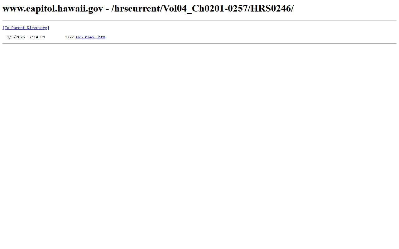
Chapter 246 makes clear that property tax is a county function, which explains why Kalawao, as a county without a county government, falls outside the normal tax system.
HRS Chapter 326 governs the Kalaupapa Settlement directly. That chapter gives the State Department of Health its authority to manage the peninsula, control access, and provide services to residents. It is the legal basis for everything the DOH does in Kalawao County.
Access to state-held records, including any records the DOH or other state agencies maintain about property in the settlement, falls under the Uniform Information Practices Act. UIPA is codified at HRS Chapter 92F. It gives the public a right to request government records in Hawaii and sets out the procedures agencies must follow. If you want records from the DOH's Kalaupapa branch or from any other state agency with records touching on the settlement, a formal UIPA request is the proper route.
Here is a summary of where to turn depending on what type of record you need:
- Taxable parcel assessments or tax bills: Maui County Real Property Assessment Division, (808) 270-7691
- Recorded deeds or conveyance instruments: Hawaii Bureau of Conveyances, Honolulu
- Settlement land use and building records: Hawaii State Archives and NPS Kalaupapa archives
- Federal park land records: Kalaupapa National Historical Park, NPS Pacific West Region
- State DOH administrative records: UIPA request to the Hawaii Department of Health
- 19th-century land tenure records: Hawaii State Archives, Land Commission and Royal Patent collections
Researchers who need certified copies of any recorded instruments affecting Kalawao County property should go to the Bureau of Conveyances. That office holds the official statewide registry of recorded real property documents. Copies can be requested in person or by mail.
The lack of property tax in Kalawao does not mean property interests there are unrecorded or unregulated. It means the usual county-level machinery for assessment, billing, and collection simply does not exist. The records that do exist are held by state agencies, the federal government, and historical archives, and they are accessible through the channels described above.
Other Hawaii Counties
The four other counties in Hawaii each have active Real Property Assessment Divisions and levy property taxes. If you need property tax records for another part of the state, use the links below.
Maui County is the most relevant for anyone with a direct connection to Kalawao, since Maui handles any taxable parcels within Kalawao's boundaries and the two areas share administrative ties.